
Woodend Mills' Weir, Mossley
Water Street Weir, Stalybridge
Old Mill Weir, Dukinfield
Broomstair Mill Weir, Denton/Hyde
Gibraltar Mill Weir, Denton/Hyde
Haughton Dale Mill Weir, Haughton Green/Denton
Arden Mill Weir, Haughton Dale/ Haughton Green/Denton
Strines Weir, Denton/Reddish
Harrison's Weir, Stockport
Introduction
A weir is an overflow-type dam used to raise the water level of a river or stream.
A substantial number of weirs were constructed during the period of the Industrial Revolution to hold back water in rivers and where necessary reservoirs,
called millponds or milldams, were constructed alongside rivers. The impounded water in a river or reservoir was then used to power a mill such as a corn mill, cotton mill or woollen mill.
The construction of a weir increased the head of water (hydrostatic head), which is the vertical distance between the water level in the river or millpond and the waterwheel or turbine used to generate hydropower.
A millrace is a water channel cut for the purpose of conducting water to or from a device, such as a waterwheel or turbine, for the purpose of producing power. The channel above the device is the 'headrace' and the channel below it is the 'tailrace'.
Many weirs were built across rivers and streams of the Pennine Hills most of which have survived even though the mills that they once powered have long since disappeared. The River Tame in Tameside features several prominent historical weirs, most of which were built during the Industrial Revolution to power local corn, textile and paper mills.
Woodend Mills' Weir, Mossley
Lat & Long: 53.52055, -2.03434
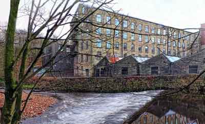
Situated further upstream in the town of Mossley, this weir historically diverted water to power the large Woodend textile mills complex.
Water Street Weir, Stalybridge
Lat & Long: 53.483147, -2.060893
Prior to the arrival of cotton mills in Stalybridge there was some domestic wool production in the Rassbottom District of Stalybridge but
in 1776 the district saw its first water-powered cotton mill and this marked a shift away from domestic production into industrial production.
This weir is associated with this early water-powered cotton mill.

Old Mill Weir, Dukinfield
Lat & Long: 53.48275, -2.08546
Dukinfield Old Mill was historically in Dukinfield and it was sited alongside the Old Mill Weir in the river Tame. Originally it was water-powered using the flow of the adjacent river Tame.
Dukinfield Old Mill and the nearby Furnace Mill were the first two cotton-spinning mills established in Dukinfield in 1792, marking the beginning of the town's industrial transformation.

Broomstair Weir, Denton/Hyde
Lat Long: 53.45500, -2.09610
Long before the construction of this weir, its location was an ancient crossing of the river Tame known as Hamnett Ford. A natural stone outcrop in the river bed made it an ideal crossing point.
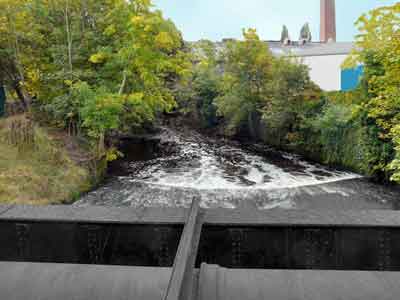
This weir is situated directly south of Broomstair Bridge (A57) and it is on the boundary between Denton/Lancashire and Hyde/Cheshire. It is probable that the it was first constructed to power a corn mill but later it may have been used to power Broomstair Mill (a paper mill) on the Denton side of the river. On the 6 Feb 1880 a sudden gust of wind blew waste paper onto a naked gas flame, completely engulfing and destroying the mill. Following the fire, Broomstair Mill was rebuilt and once again it opened for the manufacture of paper. By 1931 there had been a change of use when the mill was occupied by B W Wood Ltd, a company that specialised as raisers, finishers and combiners of cotton goods. This company went into voluntary liquidation in Oct 1980.
Currently the weir is the site of an important water-management resource and monitoring point for the National River Flow Archive to measure the water volume flowing in the river Tame. Broomstair Peak Flow Station, No. 69041, Catchment Area 113.00, opened in 1974 to measure Peak Data Flow, Daily Data and Live Data.
Gibraltar Mill Weir, Denton/Hyde
Lat & Long: 53.44092, -2.09240
This weir was built just upstrean of Gibraltar Bridge to power Gibraltar Mill, which was a cotton mill built on the left bank of the river Tame in Apethorn, Hyde.
It sits on the boundary between Haughton Dale (Denton, Lancashire) and Apethorn (Hyde, Cheshire). It was built in the late 18th century and it was demolished in the 1960s.
Haughton Dale Mill Weir, Haughton Green/Denton
Lat & Long: 53.43353, -2.10080
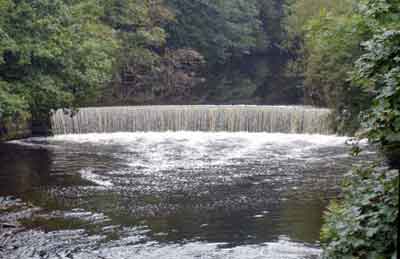
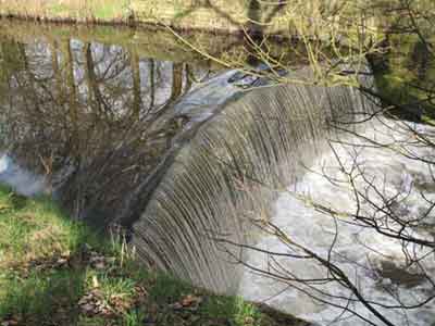
This weir was probably built in the late 18th century to power Haughton Dale Mill, which was a cotton mill built alongside the right bank of the river Tame
at the downstream end of a wide loop in the river. The weir was built across the river just below the start of the loop and the headrace was cut from above the weir directly across the loop to the mill.
At some point, said to be in 1853 (Middleton 1936), there was a change of use of the mill when James Walton (1802-5 Nov 1883), trading as James Walton & Sons, adapted them as Haughton Dale Wireworks. This business specialised in wiredrawing and making cards, the latter being wire combs used to straighten the fibres of raw cotton and wool prior to the spinning process. However, the date of 1853 for the establishment of this business must be contrasted with company advertisements that put the year of establishment as 1814. In this case Isaac Walton, father of James Walton, who was a merchant, founded the business. James Walton was born in Stubbin or Somerby, Yorkshire. This business closed on the 12 Mar 1903 and by 1936 the mill had been demolished.
Arden Mill Weir, Haughton Dale/Haughton Green/Denton
Lat & Long: 53.43330, -2.10583
This weir was built just downstream of Arden Bridge to power Arden Mill, which was erected as a corn mill on the left bank of the river Tame in Bredbury.
The present weir is the second one to be built, the earlier one, of which there is now no trace,
being built closer to the mill. The date of construction of the mill is uncertain. It probably dates from the late 18th century and it was certainly extant by 1812. Later, it became a paper mill and during the Great War (1914/18) the government requisitioned
it for the manufacture of gun cotton (probably cordite). However, before production had properly commenced an accident occurred that resulted in an explosion that destroyed the mill.
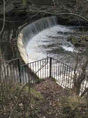
A conspicuous feature of Arden Weir is that it was sited about 600 yards upstream of Arden Mill. This had the effect of increasing the head of water available at the mill for the generation of hydropower. The mill race or leat, carrying water to the mill, was constructed alongside the left bank of the river. In the early 20th century, prior to the outbreak of the Great War in 1914, two water turbines were installed at the mill to generate hydroelectric power. It is understood that these turbines generated up to 300 IHP (224kW) and this powered the mill as well as an adjoining row of cottages.
Strines Weir, Denton/Reddish
Lat & Long: 53.43834, -2.13890
Strines Weir was a historic weir on the river Tame in Reddish Vale, located on the boundary between Denton/Lancashire and Reddish/Lancashire then Cheshire.
It was first built to power a local medieval manorial corn mill, later expanded to feed reservoirs for the Reddish Vale Print Works.
This mill is first mentioned in a charter dating back to the late medieval period.
Under a system known as ‘mill soke’, the Lord of the Manor made his tenants grind their corn exclusively at this mill, charging them a fee for the service.
The lane leading into Reddish Vale from North Reddish takes its name directly from this historic manorial mill.
As the Industrial Revolution grew, the weir's structure was adapted to divert water from the river Tame into adjacent mill ponds. These ponds supplied water power and processing water to the Reddish Vale Print Works, a major calico printing facility that was founded in the late 18th century. A small community developed on the south side of the river adjacent to the weir, which included Strines Farm and Strines Cottages.
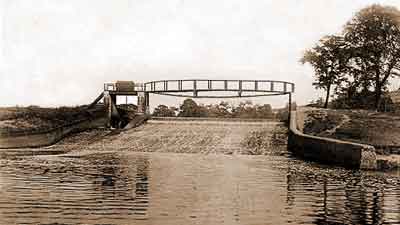
This weir was destroyed by a major flood in the 1960s.
Harrison’s Weir, Stockport
Lat & Long: 53.42343, -2.14260
Although this weir is not in Tameside it is, nevertheless, worthy of mention.
It is now located in Reddish Vale Country Park and it is the last weir on the river Tame before it joins the river Goyt to form the river Mersey just north of Stockport town centre.
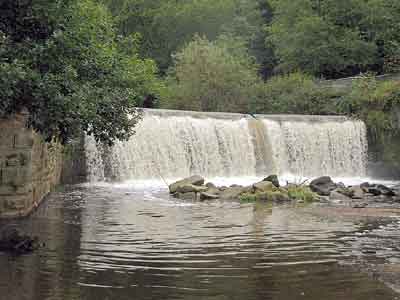
The history of the weir is associated with the Industrial Revolution and a prominent industrialist called James Harrison ( -1806). In the early 1780s, James Harrison acquired the Manor of Brinnington on the south side of the river Tame followed by the acquisition the Manor of Reddish on the other side. In buying both estates he successfully secured complete control over the water rights of this section of the river Tame.
By 1790 Harrison owned three mills, known as Portwood Mills, on Water St, Stockport. To power these he needed a reliable and substantial amount of water from the river Tame. To achieve this, he constructed a weir across the river at a site that provided a 16-foot head of water at the mills. The mill race or leat needed to deliver this water to the mills was about 0.85-mile long and it was known as the Portwood Cut.
